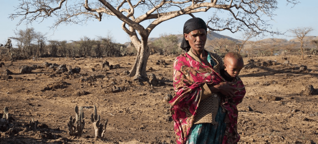
OCHA/Charlotte Cans | The El Niño-induced drought in Ziway Dugda, Oromia region of Ethiopia, is affecting every family and they don’t have enough food at home to feed themselves. (file photo).
El Niño confirmed, set to fuel more extreme weather, says WMO
The UN urged all countries on Tuesday to bolster early warning systems after confirming the onset of El Niño, warning that the Pacific Ocean-warming phenomenon will bring above-average temperatures “nearly everywhere” and fuel more extreme weather.
According to the World Meteorological Organization (WMO), there is an 80 per cent chance that El Niño conditions will emerge between June and August and a 90 per cent chance of this happening thereafter.
“This update matters because El Niño is a major driver of global weather and climate patterns,” said WMO Secretary-General Celeste Saulo. “The footprint of an El Niño travels far beyond its origins in the Pacific Ocean, impacting agriculture, energy supplies, trade, water resources, supply chains, and livelihoods across entire regions.”
At 6°C above average, tropical Pacific Ocean temperature readings are fuelling concerns that this El Niño could feed on this extra heat and devastate vulnerable and unprepared communities worldwide.
The last El Niño in 2023-24 was one of the five strongest on record and it played a role in record global temperatures registered in 2024, noted Ms. Saulo.
There is “no evidence that climate change increases the frequency or intensity of El Niño events”, according to WMO, but it can amplify associated impacts because a warmer ocean and atmosphere provide more energy and moisture for extreme weather events such as heatwaves and heavy rainfall.
Preparing for El Niño
“We understand El Niño; we can prepare much better for El Niño thanks to science and to the investment of many countries to be well prepared,” the WMO chief told journalists in Geneva. “But on top of El Niño, you have extreme events and those extreme events are requiring more and more [investment].”
Together with weather agencies worldwide, the WMO’s role in the coming months involves monitoring conditions to inform decision-making by governments, humanitarian agencies and other climate-sensitive sectors.
“Advance seasonal forecasts and early warnings are vital to save lives and cushion the impact on our economies and our communities,” Ms. Saulo insisted.
El Niño and La Niña explained
Both El Niño and La Niña are opposite phases of the El Niño–Southern Oscillation (ENSO), one of the most powerful naturally occurring climate patterns on Earth.
El Niño is characterized by a warming of ocean surface temperatures in the central and eastern Equatorial Pacific. It typically occurs every two to seven years and lasts around nine to 12 months.
It generally begins developing between March and June and reaches its peak intensity between November and February, with impacts on global temperatures typically being most pronounced in the second year after development.
ENSO events fall into four categories: weak, moderate, strong or very strong. “Even a moderate El Niño makes some weather and climate extremes more likely,” said WMO.